gettripholidays@gmail.com View Mobile Number
Gaumukh Trek Tour
Link Copied
Duration : 5 Nights / 6 Days
Destination Covered : Gangotri, Gangotri
Tour Activities : Trekking
Price on Request
Gangotri and Gangotri Tour Itinerary
Day 1
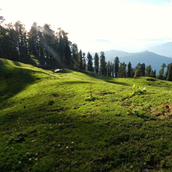
Around 20 km, before Gangotri, Dharali is surrounded by mountains and deodar forests.
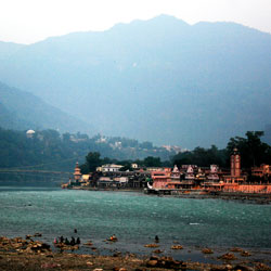
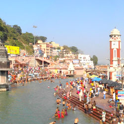
You stay overnight at Dharali but the trek begins at Gangotri the following morning. Gangotri is known as the source of river Ganga (the actual source being Gaumukh), which is known as Bhagirathi here.
It is said that King Bhagirath prayed to Lord Shiva for the salvation of the souls of his 60,000 sons. Shiva obliged and requested Goddess Ganga to release her water, which purified the ashes of Bhagirath’s sons. This mythological story elevated the status of River Ganga as a means to purify one’s soul.
Altitude: 10,055 ft (3,065 m)
Time taken: 10-12 hours drive from Dehradun to Gangotri
Day 2
Altitude: 10,055 ft (3,065 m) to 11,761 ft (3,585 m)
Time taken: 1 hour drive. Trek for 6 hours, 9 km
Trek gradient: Moderate. Initial 300 m steep ascent followed by a very gradual ascent all the way.
Water sources: Carry sufficient water from Gangotri. You can refill your water bottles from streams on the way.
Start for Gangotri early in the morning We will arrange cabs to take you there from Dharali.
The trail to Chirbasa goes through a Forest Check Post around 2 km from Gangotri bus stand. A trail goes up from the bus stand towards the left side inside the forest. The trail runs on the left side of the market area and one can take multiple trails from inside of the market to connect with the trail. Walk till you reach the Forest Check Post.
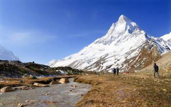
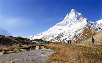
This may take around 15-30 minutes, depending on where you start from within Gangotri. From here, spot a striking white peak in the distance. This is Sudarshan Parbat (21,345 ft), looking stunning in the background. It lies in a cluster of many major peaks. After getting the permits checked, proceed on the trail that remains on the left side of the mountain ridge throughout the day. The Bhagirathi River remains below, always to your right. There are a few isolated glaciers on the river that are melting rapidly.
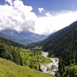
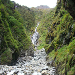
In around 15 minutes, you will come across the first of many waterfalls and streams that you will see today. The trail mostly has gradual inclines and level walks. Trek for another 20-30 minutes and you will see another stream gushing below a makeshift bridge. After crossing the bridge, the valley opens up and turns right. Feast your eyes on the several snow-capped mountain ranges on the right side of the valley. After 20 minutes, you will see the third major stream on your path. Sudarshan Parbat is now no longer visible. The trail remains consistent for another 45 minutes. Now, the path swirls further towards your right as you cross the third ridge, giving way to a breathtaking view of the valley. Bask in a healthy presence of blue pine and silver birch trees around you.
A consistent hike of 45 minutes will bring you to a boulder zone over one of the snouts coming from Sudarshan Parbat. Cross the boulders and hike up for about 10 minutes to reach a series of dhabas.
Chirbasa is another 15 minutes away under forest cover. A special mention should be given to Himalayan Environmental Trust, who, along with the Forest Department, have been able to successfully implement an afforestation project in this area. As you pass the check post of the Forest Department, take the trail down on your right to reach the camping ground of Chirbasa. Look for a GMVN hut on a level ground next to Bhagirathi River. Camp here for the night.
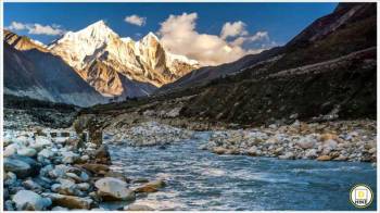
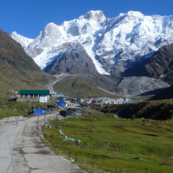
Bhagirathi river is to the right of the Chirbasa campsite. The place gets its name from the Chir trees that surround it. You get clear views of the Bhagirathi peaks from Chirbasa. Also visible in the distance is the mouth of the Gaumukh glacier.
Day 3
Altitude: 11,761 ft (3,585 m) to 12,450 ft (3,795 m)
Time taken: 3 hours, 5 km
Trek gradient: Moderate. Initial 100 m ascent to get back on the trail. Very gradual ascent all the way to Bhojbasa
Water sources: None. Carry 2 litres of water
The valley widens from Chirbasa and offers views of snow-clad peaks. Take the trail from behind the GMVN hut. The trail connects with the Gaumukh trail, which extends from forest check post. This section will take 5 to 10 minutes. Once connected with the primary trail, you will be able to see the Chirbasa campsite below. There is a minor landslide-prone section within 10 minutes from this point. After this section, the terrain is broken in certain sections but is manageable. Look for the first ridge ahead towards your left in the distance. It takes around 30-45 minutes to reach this ridge and cross the bend.
As you trudge through the silent hills, the Bhagirathi peak looms closer into view. After 20 minutes of gradual ascent, look for a stream to your left. Another 45 minutes of similar gradient will have you reach another landslide-prone area. This area has boulder gradient and a stream crossing your path. Climb up for another five minutes to traverse the second ridge/bend. There are 8-9 landslide-prone bends from here. It takes 20 to 30 minutes to traverse this section. Keep an eye for falling rocks and avoid resting. Move swiftly. After crossing this section, you will see a bridge with a stream flowing below. Bhojbasa, the widest point in the valley, is only 1.5 km from this point.
The trek to Bhojbasa is a level walk and very scenic. Around 300 m above Bhojbasa, you get a vantage point. The entire valley ahead of Bhojbasa is visible from here. This is a very beautiful sight. Also visible is a part of the Gaumukh glacier.
You get the first view of Mt Shivling at Bhojbasa. This is an open campsite – you’re far above the tree line now. Bhagirathi river flows right beside the campsite.
You will find igloo-like structures close to the campsite. You have the option of staying in these instead of camping. This requires permission from the Forest Department.
Day 4
Altitude: 10,055 ft to 12,450 ft (3,795 m)
Time taken: 7 hours, 9 km
Trek gradient:
Water sources: Carry 2 litres of water. Refill water bottles at Gaumukh.
The valley narrows as you move on the trail to Gaumukh. Take the trail from the GMVN hut going up and connecting with Gaumukh route. It takes 10 minutes till you intercept the primary trail to Gaumukh. From here, it’s a gradual ascent for about 2.5 hours all the way to Gaumukh. After 20 minutes of level walk, you reach the first glacial stream crossing. You can now see Mt. Shivling on the right.
After 20 minutes, you reach a rock face that you need to cross over. As you cross this bend, you get an unprecedented view of Gaumukh. The trail now becomes boulder moraine, but is manageable.
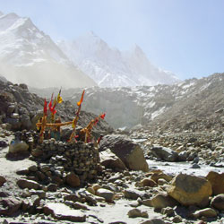
15 minutes later, you reach the second major stream crossing. Then, 20 minutes of level walk on the defined trail will get you to a level camping ground. Climb up the moraine and walk to the vantage point of Gaumukh, which is 500 metres away from the glacier. There is a small open temple of Lord Shiva here. Pilgrims are refrained from going any further unless they have permission to camp at Tapovan. Proceed from the left side of the moraine ridge and climb up another 20 metres. You now get a great view of the Gaumukh glacier. As you proceed, observe the fragmentation of the glacier and debris from the rock fall over the years.
Day 5
Altitude: 12,450 ft (3,795 m) to 14,202 ft (4,329 m)
Time taken: 8 hours, 15 km
Trek gradient: Difficult. Gradual ascent for 2.5 hours. 2 hours glacier walk followed by 1 hour of moderate ascent. Final 1.5 hours is a steep ascent.
Water sources: Carry 2 litres of water. Refill water bottles at Gaumukh.
Reach Gaumukh on the same trail as Day 4.
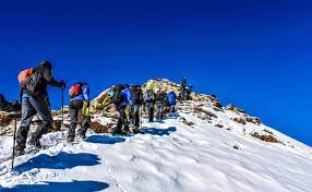
The trail from Gaumukh to Tapovan is the most difficult part of the trek. It involves climbing glacial moraine and traversing the Gaumukh glacier. You will be traversing steep landslide-prone areas and a glacial stream called Akash-Ganga.
The terminal moraine is a combination of hard ice and boulders and can get slippery in certain sections. Even with cairns marking the route, finding it can be tricky since the route goes over an active glacial basin and is always changing. The initial climb till the top of Gaumukh glacier from the left side is a 100 metre ascent. A local guide is highly advisable here. The climb up the 100 metres can take an hour and a half. The route via the terminal moraine takes almost an hour to traverse and reach. After this, you hit a rock face, which you will have to climb to get to Tapovan.
This climb is adjacent to Akash Ganga, which flows vertically down this rock face. Ensure this section is climbed before lunch time to avoid potential rock fall and increase in volume of water coming down Akash Ganga. The climb takes an hour to two, depending upon the conditions. The climb is a steep incline on loose gravel.
After about 100 metres into the climb, look for spots from where you can cross Akash Ganga. If the volume of water is high, then you need to take your shoes off and cross the stream. Otherwise, boulder hopping is also possible. Take a break after crossing the stream. You can have lunch here.
Tapovan is a steep climb from here. It will take you about 1.5 hours to reach. Look for a suitable camping spot and camp for the night.
The mountain views from the Tapovan campsite are astonishing. You can see Mt Shivling to the right. Meru is to the right of Shivling. On the left side of Shivling, a little behind, is Sumeru. Further to the left you see Bhagirathi peaks, Thenu and Sudarshan Parbat. If you walk to the ashram that is visible from the campsite, Shivling appears even closer.
Tapovan is a high-altitude alpine meadow below Mt. Shivling, which dominates the landscape. Tapovan is spread over 2 km in length. Although it’s a vast level ground, not all the land is suitable for camping. The area close to Mt. Shivling is wet during early summer due to melting snow and glacial water. These grounds have been used by many sages to meditate over the centuries. There are many such holy men living permanently at Tapovan.
A 1.5 km trek from Tapovan to the adjoining peak that connects to Neelatal brings you to a vantage point from where you get great views of Meru. This takes about 2 hours to reach from the campsite. From here, you can either walk on the ridge ahead to reach Neelatal, or walk back on the same trail to Tapovan. Neelatal seldom has any water now. Manage your time such that you’re back at the campsite by 1:30 PM.
Day 6
Altitude: 12,450 ft to 10,055 ft (3,585 m)
Time taken: 5 hours, 7 km
Trek gradient: Moderate Difficult. Level trail to Chirbasa.
Water sources: Carry 2 litres of water. You can refill your water bottles at streams along the trail.
Proceed from Bhojbasa on the same trail back to Chirbasa.
The trek involves a gradual descent and a series of level walks, which can be done swiftly. The trek back to Gangotri is the same trail taken to reach Chirbasa. It’s a very gradual descent, which takes far less time to cover than the ascent.
More Details about Gangotri and Gangotri Tour
Inclusions
- EP (No Meal)
Payments Terms
- * 20% Advance Percentage of total booking amount
Available Dates For Treks
- May
- 5 May to 12 May 19 (open)
- 12 May to 19 May 19 (open)
- 19 May to 26 May 19 (open)
- 26 May to 2 Jun 19 (open)
- Jun
- REGISTER FOR TREK
Cancellation & Refund Policy
- * Upon cancellation, refund will be made after deducting the Retention Amount.
Packages by Theme
Fill Enquiry Form Below

